
Historical Maps
Asia
( Page 2 of 5 )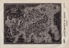
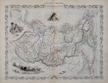
Asia Pinnock 1834
Asia Sidney Hall 1840
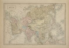
Asia Johnston 1843
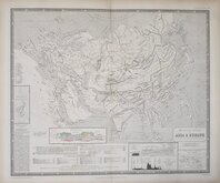
Mountain Chains Johnston 1843
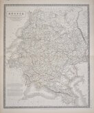
Russia in Europe Johnston 1843
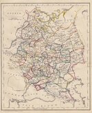
Russia Becker 1850
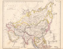
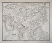
Asia Becker 1850
Russia Tallis 1851


58x45 cm
SOUTH-WEST RUSSIA
Showing the extent of THE KINGDOM OF POLAND previous to its partition in 1772 BY KEITH JOHNSTON, F.R.S.E.
by W.& A.K. Johnston, Edinburgh.
William Blackwood & Sons, Edinburgh & London.
Double page lithographic printed map by Alexander Keith Johnston (1804-1871), published in The Royal Atlas of Modern Geography...by Alexander Keith Johnston Geographer to the Queen for Scotland...William Blackwood & Sons, Edinburgh and London, 1861.
Overprinted in blue, indicating rivers and seas, and hand coloured to indicate political boundaries.
Very good condition.
Quick Links

Far East & India

Eastern Europe & Turkey
×