
Parts of Ireland & Counties
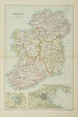
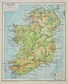
Whole of Ireland
( Page 3 of 3 )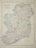
W & A K Johnston 1884
John Bartholomew 1892
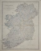
Keith Johnston 1893
John Bartholomew 1898
George Philip & Son 1920
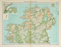
John Bartholomew 1922


24x35 cm
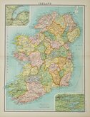
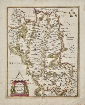
DECORATIVE MAP SURROUNDED BY FINE VIGNETTES
IRELAND.
The illustrations by J.Marchant & Engraved by J.Rogers.
The Map Drawn & Engraved by J. Rapkin.
JOHN TALLIS & COMPANY, LONDON & NEW YORK.
Drawn and engraved on steel by J. Rapkin, this series of finely engraved maps were first published in parts from the end of the 1840's and issued as a complete volume, The Illustrated Atlas in 1851. The work was re-issued a number of times until about 1865 and the maps were then used by Montgomery Martin, the author of the text in the Illustrated Atlas, in his British Colonies from 1854. The final appearance of the maps, with vignettes erased from the plate, was in geographical dictionaries and encyclopaedias until about 1880.
From the 1851 edition without centrefold in original outline hand colour.
Closed tear to lower right margin affecting the Rapkin imprint. Some fingermarking to margins Original outline hand colour. Includes original text description (complete but with tear to right edge).
Quick Links

Whole of Britain & British Isles

Scotland Maps
×