
England & Wales
Whole of Britain & British Isles
( Page 2 of 2 )
G W Bacon British Isles 1910
Richardsons British Isles 1910
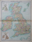
John Bartholomew 1922
John Bartholomew 1922
Electoral map 1951
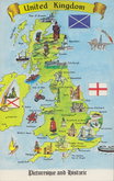
Britain Postcard 1970


43x56 cm
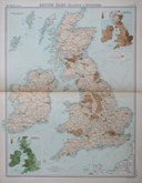
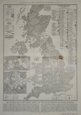
RAILWAY MAP WITH INDUSTRIAL REGIONS.
THE BRITISH ISLES - RAILWAYS & INDUSTRIAL
Large double page colour printed lithograph by John Bartholomew & Son Ltd. published in The Times Atlas and Gazetteer of the World by the Edinburgh Geographical Institute 1922.
Inset maps of ORKNEY & SHETLAND ISLANDS, DISTRIBUTION OF LAND UNDER CULTIVATION, DISTRIBUTION OF LAND UNDER PASTURE
Quick Links


Scotland Maps

Wales Maps
×