
Scotland Maps
Whole of Britain & British Isles
( Page 1 of 2 )
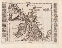
Roman Britain Robert Morden 1695
Daniel de la Feuille 1720
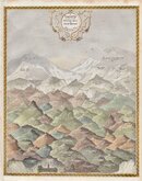
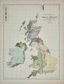
Hills of Britain 1842
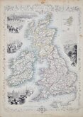
John Rapkin 1851
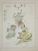
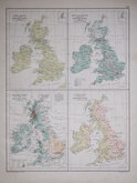
Palaeontological Johnston 1884
Ethnographic Johnston 1884
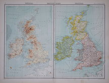
Products Population Rainfall Rivers 1892
John Bartholomew 1898


43x56 cm
POLITICAL MAP
THE BRITISH ISLES - POLITICAL
Large double page colour printed lithograph by John Bartholomew & Son Ltd. published in The Times Atlas and Gazetteer of the World by the Edinburgh Geographical Institute 1922.
Inset maps of ORKNEY & SHETLAND ISLANDS, INDUSTRIAL SKETCH MAP, DENSITY OF POPULATION
Quick Links


England & Wales

Wales Maps
×