
Lancashire Maps
Westmorland Maps
( Page 3 of 4 )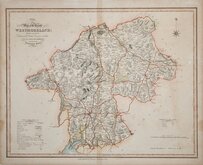
William Ebden 1833
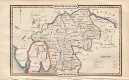
Robert Scott 1833 [1843]
Joshua Archer 1834
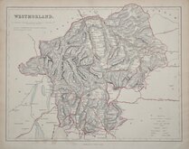
John & Charles Walker 1835 [1887]
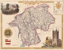
Thomas Moule 1837 [1845]
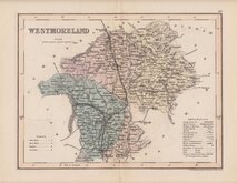
James Pigot 1839
Joshua Archer 1842 [1858]
F. P. Becker 1845


45x35 cm
UNCOMMON. DEPICTING THE REFORM BILL DIVISIONS.
Map of the County WESTMORELAND; Divided into Wards Containing the District Divisions and other LOCAL ARRANGEMENTS effected by the REFORM BILL.
London. Published by J. Duncan Paternoster Row.
This series of maps were first publised as loose sheet maps between 1824 and 1828 by various publishers, they first appeared in atlas form with revised titles to the maps (referring to the Reform Bill) in 1833 published by James Duncan. Several re-issues followed until 1845.
A little general toning to the paper and two repaired tears extending 15mm into the map at top and right margins but still a good example of an uncommon map in fine hand colour.
Quick Links


Cumberland Maps

Yorkshire Maps
×