
Middlesex Maps
Ward Plans and Parts of London
( Page 1 of 8 )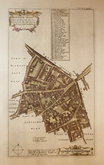
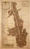
Aldgate Ward 1720
Aldgate Ward 1720
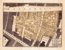
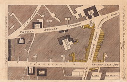
Cornhill Fire 1748
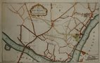
Westminster 1753
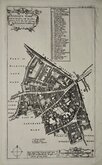
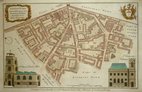
Aldersgate Ward. 1755
Aldgate Ward 1756
Bishopsgate Fire 1765
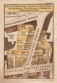
Bishopsgate Fire 1765


82x63 cm
PLAN | OF THE | PARISH OF WEST HAM, | IN THE | COUNTY OF ESSEX, | 1855.
Day & Son Lith.rs to the Queen
Large detailed plan overprinted in blue green and red. The green indicates land to be let for building purposes. Blue indicates open sewers, drainage ditches and rivers. Red indicates proposed new sewers.
Folded map with short splits to folds along top edge a couple extending into map a little now repaired with archival tape verso.. Similar repairs to a few fold intersections. Generally in good condition especially for a utilitarian map of this age.
Quick Links


Environs of London

Central London
×