
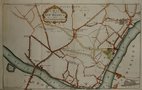
Environs of London
Ward Plans and Parts of London
( Page 1 of 8 )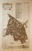
Aldgate Ward 1720
Aldgate Ward 1720
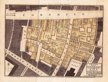
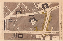
Cornhill Fire 1748
Westminster 1753
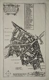
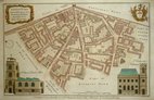
Aldersgate Ward. 1755
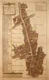
Aldgate Ward 1756
Bishopsgate Fire 1765
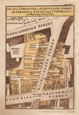
Bishopsgate Fire 1765


8x14 cm
Walk, 15th
Cavendish Square
Engraved by J.Greig from a sketch by W. Moreland for the Walks through London.
Published by W. Clarke New Bond Street. Apr 1.1817
Plan of Marylebone from Edgware Road to Tottenham Court Road and Oxford Street to Marylebone Road. No compass point but North is to the right. Vignette of Cavendish Square (looking North No 11 Cavendish square in the centre).
Published in Walks Through London including Westminster and the Borough of Southwark…forming a complete guide to the Metropolis…by David Hughson, L.L.D.. London, Sherwood Neely & Jones. 1817.
Hand coloured.
Quick Links


Middlesex Maps

Central London
×