
Environs of London
Ward Plans and Parts of London
( Page 1 of 8 )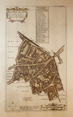
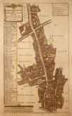
Aldgate Ward 1720
Aldgate Ward 1720
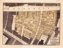
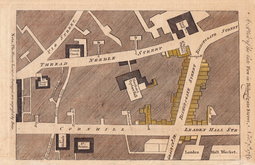
Cornhill Fire 1748
Westminster 1753
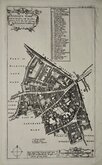
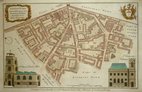
Aldersgate Ward. 1755
Aldgate Ward 1756
Bishopsgate Fire 1765
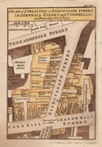
Bishopsgate Fire 1765


9x15 cm
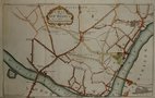
Walk 18.th
Blackfriars Bridge.
Drawn and Engraved by J. Greig for the Walks through London.
Published by W. Clarke New Bond Street. April.1.1817
Plan of the Blackfriars area from Borough Road to the Thames with vignette of the first Blackfriars Bridge by Robert Mylne of nine arches built of Portland stone and originally named William Pitt Bridge. The workmanship was faulty and it was demolished in 1860.
Published in Walks Through London including Westminster and the Borough of Southwark…forming a complete guide to the Metropolis…by David Hughson, L.L.D.. London, Sherwood Neely & Jones. 1817.
Hand coloured.
Quick Links


Central London

Middlesex Maps
×