
Essex Maps
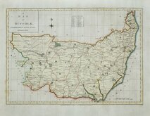
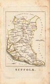
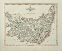
Suffolk Maps
( Page 1 of 4 )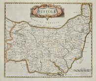
Robert Morden 1695 [1722]
Emanuel Bowen 1720
Thomas Kitchin 1748 [c.1786]
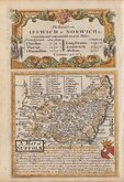
Thomas Kitchin 1764
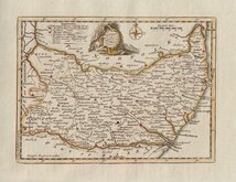
Thomas Conder 1784
John Haywood 1791
Robert Butters 1803
John Cary 1808 [1809]


27x20 cm
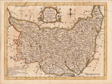
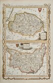
HIGHLY DECORATIVE VICTORIAN MAP
SUFFOLK
This series of decorative steel-plate engraved maps are commonly known by the name Thomas Moule as they were first issued from May 1830 in a series of parts of The English Counties Delineated written by him. The engraving of the plates was shared between James Bingley, W. Schmollinger and John Dower. Confusingly the engravers names were changed after the first issue on a number of plates.
Following the parts issue, the first complete edition of The English Counties Delineated was published by George Virtue in 1837 several editions followed until 1839 and the plates were extensively used thereafter by George Virtue and his son James Sprent Virtue in A Complete and Universal Dictionary of the English Language by the Rev. James Barclay until 1857.
The maps were frequently updated to reflect the rapidly developing railway network.
This example is from the 1842 edition published in Barclays Universal Dictionary.
Includes vignettes of Euston Hall and Heveningham Hall.
Fine later hand colour.
Quick Links

Norfolk Maps

Cambridgeshire Maps
×