
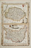
Essex Maps
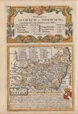
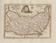
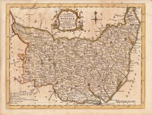
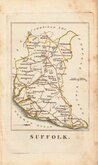
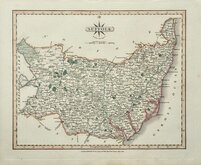
Suffolk Maps
( Page 1 of 4 )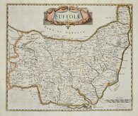
Robert Morden 1695 [1722]
Emanuel Bowen 1720
Thomas Kitchin 1748 [c.1786]
Thomas Kitchin 1764
Thomas Conder 1784
John Haywood 1791
Robert Butters 1803
John Cary 1808 [1809]


24x20 cm
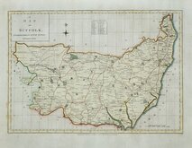
WILLIAM IV MAP BY A FEMALE ENGRAVER
SUFFOLK.
ENGRAVED BY S. HALL.
London, Published by Chapman & Hall No. 186 Strand, Jany.1832.
This series of maps first appeared in Gorton's Topographical Dictionary issued in parts over a three year period from 1830, the complete work not published again after 1833. The maps were then issued in A New British Atlas…, Sidney Hall's British Atlas…, A Travelling County Atlas… and other variations on the title, from 1834 until c.1888. It's popularity due in part to the continuous updating of the plates to include the latest railways. The maps were intaglio printed until c.1858 and then by lithographic transfer.
Original outline hand colour.
It has been assumed that all the maps for this series were engraved by Sidney Hall (1788?-1831), but Sidney Hall married Selina Price (1780?-1853) in 1821 and his engraving business was continued by his wife after his death in 1831 who signed her maps "S.Hall.". She was clearly a highly skilled engraver, presumably trained by her husband, and stylistically there is little difference in their work. Sidney Hall usually signed his maps “Sidy. Hall” so it is reasonable to assume that maps produced around the time of his death signed “S.Hall” are by Selina Hall. She is recorded as an engraver on the 1842 Census, living in Bury Street with a servant. She was buried 23 Nov.1853 at St. George, Bloomsbury. In her will, she left her books, maps etc., to her nephew Edward Weller (1819-1884) who took over the Bury Street premises and continued the business.
First issue.
Vertical folds as issued. Good hand colour.
Quick Links


Cambridgeshire Maps
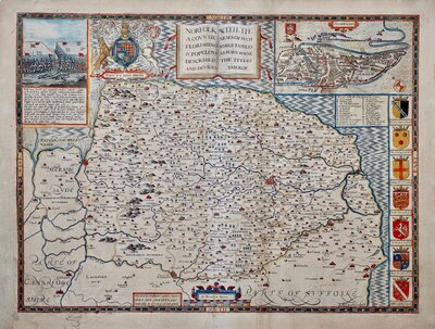
Norfolk Maps
×