
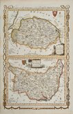
Essex Maps
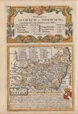
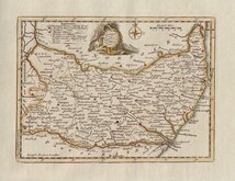
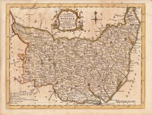
Suffolk Maps
( Page 1 of 4 )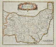
Robert Morden 1695 [1722]
Emanuel Bowen 1720
Thomas Kitchin 1748 [c.1786]
Thomas Kitchin 1764
Thomas Conder 1784
John Haywood 1791
Robert Butters 1803
John Cary 1808 [1809]


31x24 cm
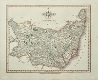
DIVIDED INTO THE POOR LAW UNIONS
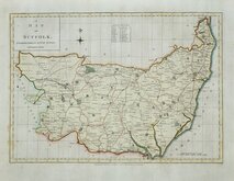
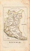
SUFFOLK
Drawn by R. Creighton | T. Starling sculp. Wilmington Square, London.
DRAWN AND ENGRAVED FOR LEWIS' TOPOGRAPHICAL DICTIONARY.
Copper engraving by Thomas Starling (1796-1850) from a drawing by Roger Creighton (1796-1838) for publication in A Topographical dictionary of England… published by Samuel Lewis and Co. from 1831. The work achieved considerable success and was re-issued many times by Lewis until 1849. During this time the maps were amended and updated to include electoral information and the rapidly expanding railway network, with most counties known in at least six different states.
This example of the map of Suffolk, which includes the division of the county into the poor-law unions, was published from 1840 -1845 . The original outline hand colour depicts these new administrative boundaries.
Fold as issued. Some occasional spotting and a diagonal crease to top right corner outside the printed area but within the plate mark.
Quick Links


Cambridgeshire Maps
Norfolk Maps
×