
Mediterranean
Sea Charts
( Page 1 of 3 )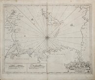
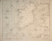
Greenville Collins Irish Sea 1688 [c.1693]
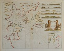
Orkney 1693
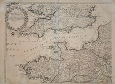
English Channel by Petrini 1715
Bay of Toulon 1739
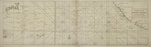
Pacific Ocean by Anson 1748
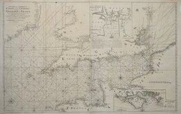
English Channel 1753
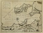
Burnham Flamborough Head Berwick 1755
Mount & Page 1756


66x100 cm
Halmahera, Maluku Islands, Indonesia.
Admiralty Sea Chart
Engraved 1932 with small corrections to 1970
Title:
EASTERN ARCHIPELAGO | HALMAHERA | AND THE ADJACENT ISLANDS | FROM THE NETHERLANDS GOVERNMENT CHARTS TO 1930 | ....
Imprint:
London. Published at the Admiralty 14th Nov.1932 under the Superintendance of Captain J.A.Edgell,O.B.E.,R.N., Hydrographer.
Marker pen number on verso has some bleed through on the face in the margin top left corner, otherwise very good condition.
Quick Links

Maritime
Map Books
×