
Map Books
Sea Charts
( Page 1 of 3 )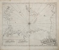
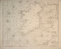
Greenville Collins Irish Sea 1688 [c.1693]
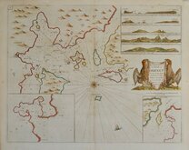
Orkney 1693
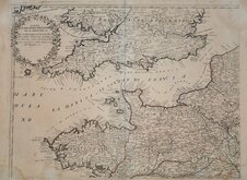
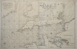
English Channel by Petrini 1715
Bay of Toulon 1739
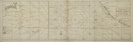
Pacific Ocean by Anson 1748
English Channel 1753
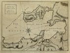
Burnham Flamborough Head Berwick 1755
Mount & Page 1756


£35 Burnham Flamborough Head Berwick
Ref: 6459wg
Add to
basket
Thanks,Your Product Has Been Added To Basket

29x47 cm
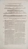
To sail between Burnham and Flamborough-head.
To sail between Flamborough-head and Berwick.
Printed on both sides of the page. Woodblock engravings and text description of the North Coast of England between Flamborough Head and Berwick.
Published in The English Pilot by Mount & Page.
Richard Mount (1654-1722), bookseller, mapseller chartseller and publisher. Apprenticed to bookseller, chartseller and instrument maker William Fisher (1631-1692) for eight years until 1670. He became Fisher's from about 1677 and married his daughter Sarah Fisher in 1682. he took over the business on Fisher's death in 1692. Sometime around 1701 he took Thomas Page (fl.1700-1733) into partnership. The firm specialised in the publication of sea charts including Greenvile Collins Coasting Pilot, John Sellers English Pilot, Atlas Maritimus, and several other works in co-partnership with other publishers.
Quick Links
Maritime

Mediterranean
×