
Maritime
Sea Charts
( Page 1 of 3 )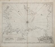
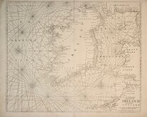
Greenville Collins Irish Sea 1688 [c.1693]
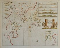
Orkney 1693
English Channel by Petrini 1715
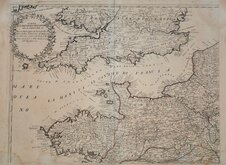
Bay of Toulon 1739
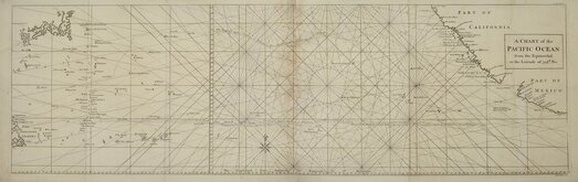
Pacific Ocean by Anson 1748
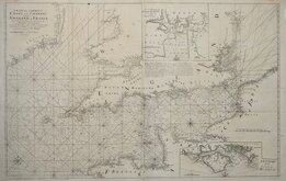
English Channel 1753
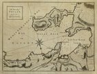
Burnham Flamborough Head Berwick 1755
Mount & Page 1756


26x20 cm
The Road,s of | TOULON, | with the | adjacent Country.
Anonymous copper engraving published in The Gentleman's Magazine...D. Henry and R. Cave. London, April 1759 at the height of the Seven Years' War between Britain and France.
The "roads" in the title refer to the smaller bays in the Bay of Toulon. North is to the bottom of the page.
Toulon has been at the centre of several important battles;
Battle of Toulon saw the defeat of the British by the Franco-Spanish Fleet in February 1744.
During the Seven Years War, a large French force was assembled at Toulon for an attack on Menorca on 20th May 1756, the opening sea battle of the Seven Years War between French and British fleets. The French won the battle.
Following the Siege of Toulon (Aug.28-Dec.1793) in which the young artillery officer Napoleon Bonaparte first won military recognition for forcing the withdrawal of the Anglo-Spanich fleet.
The map was closely copied by John Cary in 1781 but lacking depth soundings, and by John Lodge for publication in The Political Magazine also in 1781 with North to the top of the page.
Vertical folds and repair to margin bottom right corner not affecting the printed area. Good clean map in good later hand colour.
Quick Links

Mediterranean
Map Books
×