
Maritime
Sea Charts
( Page 1 of 3 )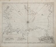
Greenville Collins Irish Sea 1688 [c.1693]
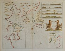
Orkney 1693
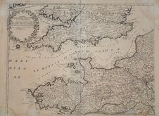
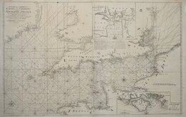
English Channel by Petrini 1715
Bay of Toulon 1739
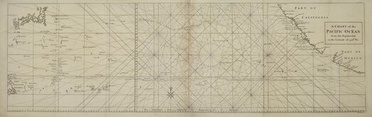
Pacific Ocean by Anson 1748
English Channel 1753
Burnham Flamborough Head Berwick 1755
Mount & Page 1756


50x44 cm
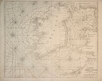
SEA CHART OF THE COAST OF IRELAND AND THE WEST COAST OF ENGLAND AND WALES
A CHART of the Coasts of IRELAND and Part of ENGLAND
Sold by Willm.Mount & Thos.Page on Tower Hill.
Following the Dutch dominance in the production of sea charts, the series of English Pilot books was started by John Seller in 1671 and was republished and augmented with additional charts through 37 editions until 1794.
This chart of the coasts of Ireland is from an edition pubished by William Mount (1688-1769) and Thomas Page (1704-1762) about 1756. Despite the popularity and large number of editions of the work, due to it's practical nature and use, the atlas or charts from any edition are uncommon.
There is a very light diagonal crease running through the Isle of Man but the chart is still a very good example.
Quick Links
Map Books

Mediterranean
×