
Whole of Scotland
Scottish Islands
( Page 1 of 1 )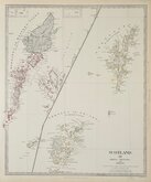
Shetland Orkneys & Hebrides. Walker 1834

Shetland Islands 1860
Edward Weller 1867
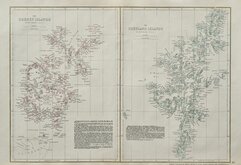
Western Isles. 1868
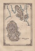
Bute. Johnston 1868
Islands of Northern Britain Alfred Taylor 1936

£15 Islands of Northern Britain Alfred Taylor
Ref: 5810.8
Add to
basket
Thanks,Your Product Has Been Added To Basket

30x18 cm
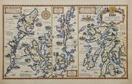
ESSO PICTORIAL PLAN OF THE PRINCIPAL ISLANDS OF NORTHERN BRITAIN
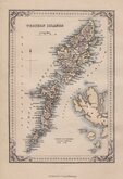
The OUTER HEBRIDES and ISLE of SKYE
The SHETLAND ISLES
The ORKNEY ISLES
The INNER HEBRIDES and ISLE of ARRAN
A.E.TAYLOR
Colour printed map drawn by Alfred Edward Taylor (1887-1959) and published in Pictorial Britain and Ireland...Designed by Alfred Taylor Described by S.P.B.Mais...H.K. McCann Company Limited, for Anglo-American Oil Company Ltd., London 1936.
Petre Mais writes in his foreword to the work;
"I have seldom, if ever, seen a happier blending of the artist and wit in a cartographer...[the maps] are jolly, they are informative, they are original, and they have a magic enticing quality about them... "
Quick Links


Parts of Scotland

Sea Charts
×