
Asia
Scandinavia
( Page 1 of 4 )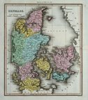
Denmark by Thomson 1820
Denmark by Wyld 1824
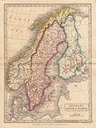
Scandinavia by Hall. 1826
Sweden & Norway by Starling 1831
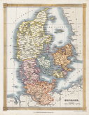
Denmark by Starling. 1831
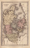
Denmark by Johnston. 1843
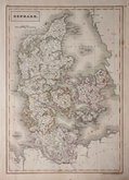
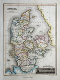
Denmark by Hall. 1844
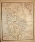
Denmark by Findlay 1845

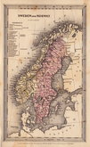
£20 Sweden & Norway by Johnston
Ref: a6012.24
Add to
basket
Thanks,Your Product Has Been Added To Basket

44x58 cm
SWEDEN & NORWAY | (SCANDINAVIA) | BY KEITH JOHNSTON. F.R.S.A.
Inset town plan of STOCKHOLM.
Lithographic printed map published in Keith Johnston's General Atlas under the full title:
The Royal Atlas Of Modern Geography Exhibiting, In A Series Of Entirely Original And Authentic Maps, The Present Condition Of Geographical Discovery And Research In The Several Countries, Empires, And States Of The World By The Late Alexander Keith Johnston ... With Additions And Corrections To The Present Date By T.B. Johnston ...W.& A.K. Johnston, Edinburgh And London, MDCCCXCIII.
Overprinted in blue indicating rivers and sea and hand coloured in line and wash indicating political boundaries.
Stain to centrefold and repair to centrefold split affecting left border.
Quick Links


Eastern Europe & Turkey

Whole of Europe
×