
Eastern Europe & Turkey
Scandinavia
( Page 1 of 4 )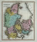
Denmark by Thomson 1820
Denmark by Wyld 1824
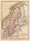
Scandinavia by Hall. 1826
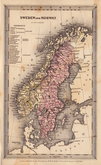
Sweden & Norway by Starling 1831
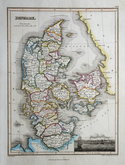
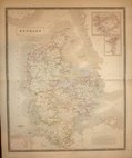
Denmark by Starling. 1831
Denmark by Johnston. 1843
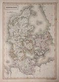
Denmark by Hall. 1844
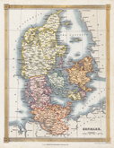
Denmark by Findlay 1845


25x34 cm
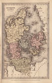
DENMARK.
Drawn and engraved on steel by J. Rapkin, this series of finely engraved maps were first published in parts from the end of the 1840's and issued as a complete volume, The Illustrated Atlas in 1851. The work was re-issued a number of times until about 1865 and the maps were then used by Montgomery Martin, the author of the text in the Illustrated Atlas, in his British Colonies from 1854. The final appearance of the maps, with vignettes erased from the plate, was in geographical dictionaries and encyclopaedias until about 1880.
Vignettes of Copenhagen, Elsinore, Arms of The Prince of Denmark, Sleswig.
Original hand colour. Centrefold.
Quick Links


Asia

Whole of Europe
×