
Mediterranean
Parts Regions & Departments of France
( Page 1 of 19 )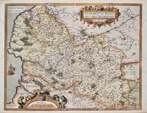
Artois by Ortelius 1587
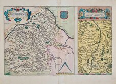
Loire by Ortelius 1587
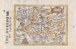
Anjou by Hondius 1637
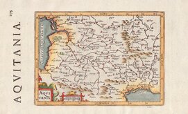
Aquitaine by Hondius 1637
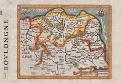
Boulogne by Hondius 1637
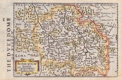
Bourbonnais by Hondius 1637
Champagne by Hondius 1637
L'Isle de France by Hondius 1637


49x31 cm
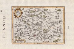
REGIONIS BITRURIGUM EXACTISS DESCRIPTIO PER D. IOANNEM CALAMAEUM
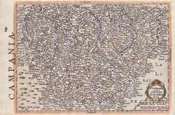
LIMANIAE TOPOGRAPHIA GABRIELE SYMEONON AUCT.
Two regional maps of Loire and Clermont-Ferand by Abraham Ortelius published in his Theatrum Orbis Terrarum from 1587.
Abraham Ortelius stated that most of the maps were engraved "by the cunning hand of Frans Hogenburg" at Cologne.
Abraham Ortelius (1527-1598) was a Brabantian geographer and cartographer recognised as the creator of the first modern atlas Theatrum Orbis Terrarum. First published in 1570 with 70 maps, the work was re-issued and expanded with additional maps and in several languages until the final appearance in 1612 with 167 maps.
The larger map shows the Loire region from Gien in the North to Le Blanc in the south including Romorantin-Lanthenay, Bourges, Vierzon, Issoudun, Chateauroux.
The smaller map shows a region around the river Allier including Beauregard-l'Eeque, Pont-du-Chateau, Clermont-Ferrand, Puy-Guillaume.
Slight discolouration at centrefold, otherwise good in original hand colour.
Quick Links

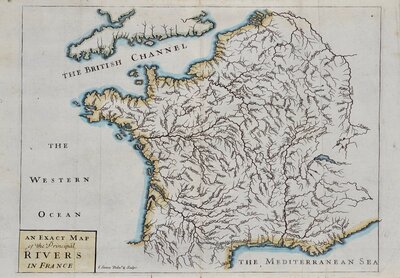
Whole of France

Whole of Europe
×