
John Cary
Owen & Bowen
( Page 5 of 19 )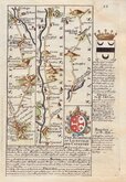
Litchfield Chester
Chester Holyhead
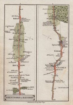
London Bagshot
Basingstoke Salisbury
Shaftsbury Exeter
Plymouth Fowey
Penzance Lands End
London Brighton


12x18 cm
Plates 15 & 16.
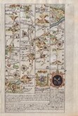
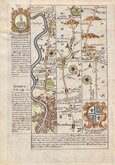
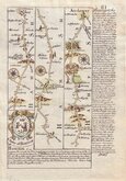
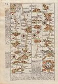
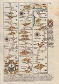
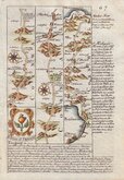
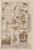
Part of the road from London to Berwick showing Great Ponton, Grantham, Gonerby Hill Foot, Manthorpe, Sedgebrook, Allington, Foston, Westborough, Long Bennington, Balderton, Newark on Trent, Coddington, Winthorpe, South Muskham, North Muskham, Cromwell, Norwell, Carlton on Trent, Ossington, Sutton on Trent, Weston, Egmanton, Tuxford (over page), Tuxford, East Markham, West Markham, West Drayton, Elkesley, Gamston, Ordsall, Babworth, Bilby, Barnby Moor, Sutton cum Lound, Torworth, Ranskill, Serlby, Scrooby, Bawtry, Rossington, Doncaster, Cusworth, Scawsby, Bentley, Pickburn, Hampole.
Arms and description of Newark and Grantham.
Repair to water damage to top corner which has resulted in loss of plate number 16 and some text at beginning of the description of Doncaster. Despite the faults, the map is a clean and strong impression in the first printed state in fine later hand colour.
Quick Links
Roads by other Mapmakers

John Ogilby
×