
Durham Maps
Northumberland Maps
( Page 1 of 4 )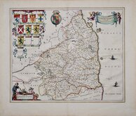
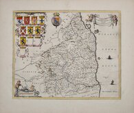
Jan Blaeu 1645
Jan Blaeu 1645 [1664]
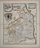
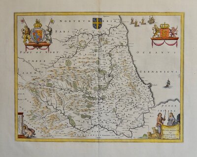
Richard Blome 1673
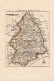
Robert Morden 1695 [1753]
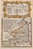
Emanuel Bowen 1720
Thomas Read 1743 [1753]
Joseph Ellis 1765 [1773]
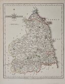
John Cary 1787 [1793]


20x25 cm
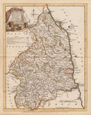
DETAILED ENGRAVING WITH HATCHURING FOR HILLS
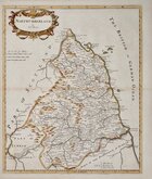
NORTHUMBERLAND.
Neele Sculpt. Strand.
Published by J. Robins & Co. Albion Press London January 1.1818.
Drawn and engraved by Samuel John Neele (1758-1824), this series were based on John Cary's 'quarto' maps of 1793. The early publication is complex, with loose maps and parts issues for many counties from about 1812. The first publication containing the complete set of county maps was The New British Traveller; or, modern panorama of England and Wales...By James Dugdale... published about 1819 by J & J Cundee. The maps appeared in three further issues with the imprint of J. Robins & Co. under various titles.
Samuel John Neele was a prolific engraver working from Russell Court from 1781 and 352 Strand from 1785-1824. He traded with his younger brother George Neele as “S.& G. Neele” 1826-1824 and with his son James Neele as “Neele & Son” 1816-1824.
This map of Northumberland is the second state published by Robins & Co.in 1819 & 1820. Neat hand colour. Re-margined right edge. Some bleed through from colouring verso.
Ref. Whitaker Maps of Northumberland 353
[The first state with Cundee imprint is not listed in Whitaker]
Quick Links

Cumberland Maps

Scotland Maps
×