
Durham Maps
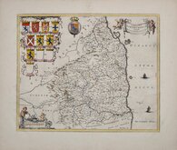
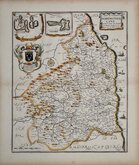
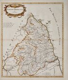
Northumberland Maps
( Page 1 of 4 )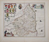
Jan Blaeu 1645
Jan Blaeu 1645 [1664]
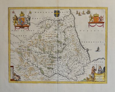
Richard Blome 1673
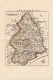
Robert Morden 1695 [1753]
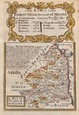
Emanuel Bowen 1720
Thomas Read 1743 [1753]
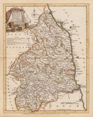
Joseph Ellis 1765 [1773]
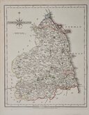
John Cary 1787 [1793]


20x25 cm
FINELY ENGRAVED MAP WITH PASTORAL TITLE CARTOUCHE.
A Modern MAP of NORTHUM-BERLAND, Drawn from the latest Surveys: Corrected & Improved by the best Authorities.
Printed for Rob.t Sayer in Fleet Street & Carington Bowles in S.t Pauls Church yard.
First published in The New English Atlas… in 1765, the atlas became a considerable success with many editions, under the title Ellis's English Atlas, being published over a period of thirty years from the offices of Robert Sayer and Carington Bowles. Its popularity was due to it's cartographical clarity while being of pocket size making it useful for the traveller as well as everyday use in academies and the home. Most of the maps were copied from those by Thomas Kitchin in a rival publication of similar pocket size, England Illustrate…by Robert Dodsley, first published in 1763 which did not achieve the same commercial success.
This example of the map of Northumberland is from the 1773 edition of Ellis's English Atlas.
Ref. Whitaker Maps of Northumberland 251
Quick Links

Scotland Maps

Cumberland Maps
×