
Cumberland Maps
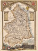
Northumberland Maps
( Page 3 of 4 )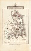
John Cary 1822
Roger Creighton 1831 [1842]
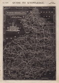
Joshua Archer 1833
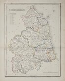
Robert Gray 1833
Robert Gray 1833 [1840]
Thomas Moule 1837 [1844]
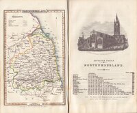
James Pigot 1839
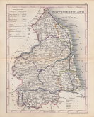
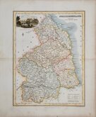
Joshua Archer 1842 [1848]

ORIGINAL WASH COLOUR
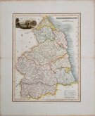
NORTHUMBERLAND
Drawn & Engraved by J.Archer, Pentonville, London.
First published in Curiosities of Great Britain, England and Wales Delineated…by Thomas Dugdale by L. Tallis in 1842. The work was re-issued a number of times until 1860. The maps also appeared in The Universal English Dictionary…by the Rev. James Barclay and finally in Tallis's topographical dictionary of England & Wales in 1860.
This example is from the 1858 edition of Dugdale's England and Wales Delineated in original hand colour. Offsetting and spotting.
Whitaker, Maps of Northumberland ref. 566.
Quick Links


Scotland Maps
Durham Maps
×