
Cumberland Maps
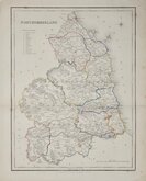
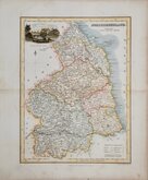
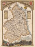
Northumberland Maps
( Page 3 of 4 )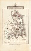
John Cary 1822
Roger Creighton 1831 [1842]
Joshua Archer 1833
Robert Gray 1833
Robert Gray 1833 [1840]
Thomas Moule 1837 [1844]
James Pigot 1839
Joshua Archer 1842 [1848]


21x26 cm
CARY'S "QUARTO" SERIES.
FINE EXAMPLE IN ORIGINAL HAND COLOUR. INCLUDING TEXT PAGE.
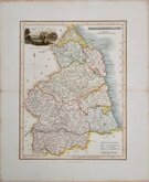
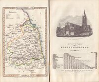
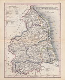
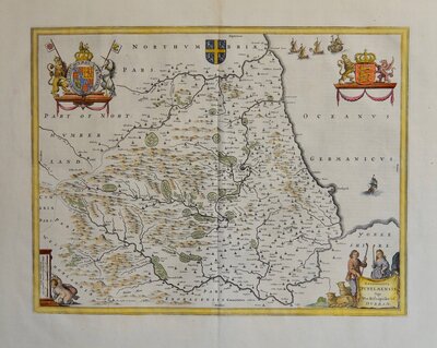
NORTHUMBERLAND
By J.CARY, Engraver.
London: Published July 1.1809 by J.Cary Engraver & Map seller N.o181 Strand.
Copper engraving by John Cary (1754-1835). This series of Maps, commonly known as his 'quarto' series, were published in Cary's New and Correct English Atlas and were justifiably popular, running to many editions from 1787 until about 1804. In 1808 an entirely new set of maps were engraved to replace the worn plates extending the publication until 1843. These new 1808 plates were first dated 1793 to preserve uniformity during transition and first issued in in 1808 in an atlas dated 1793 composed of both old and new plates. Lithographic transfers from the plates by later publishers continued publication until about 1876 giving a life of nearly 90 years for Cary's maps.
This example of the map of Northumberland is from the re-engraved plate published in Cary's New and Correct English Atlas of 1809 and is in fine original hand colour. Includes original page of typeset text description of Northumberland.
Ref. Whitaker Maps of Northumberland 325
Quick Links

Durham Maps

Scotland Maps
×