
Durham Maps
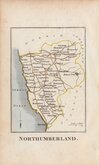
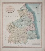
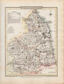
Northumberland Maps
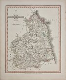
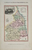
( Page 2 of 4 )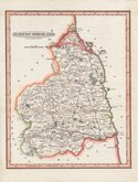
Benjamin Baker 1793
Robert Butters 1803
John Cary 1807
George Cole 1808
John Cary 1808 [1809]
Edward Langley 1818
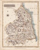
Samuel John Neele 1819
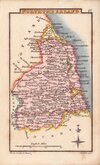
Sidney Hall 1820


26x31 cm
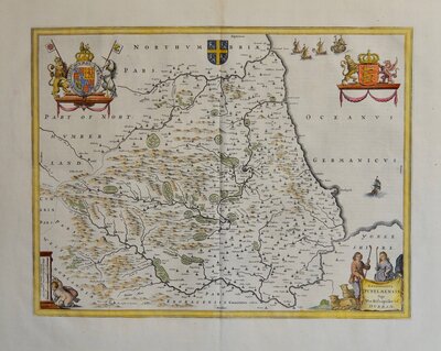
DECORATIVE MAP WITH INSETS OF FARNE AND HOLY ISLANDS
A MAPP OF YE COUNTY OF NORTHUMBER LAND WITH YE ISLES OF FARNE & HOLY ISLAND by Ric: Blome, by his Maty comand
Originally a heraldic painter, Richard Blome (fl.1660-1705; d.1705) was a compiler and publisher of many geographical and heraldic works. His contemporaries were not complimentary about his publishing methods, his methods of obtaining sponsorship, or his productions. This series of maps were produced quickly following an announcement in the press by John Ogilby of his intention to produce a new work of county maps, road maps and town plans entitled Britannia. Blome’s maps are crudely engraved, typical of journeyman work, and mostly copied from those of John Speed. The printing, however was of the highest standard, being carried out by Thomas Roycroft, printer to King Charles II. Richard Blome shamelessly used the same title announced by John Ogilby for his work, commencing publication in 1673. The edition probably being on sale for four years. There was a re-issue of 1677 made up by John Wright from remaindered sheets.
Inset maps of Farne islands and Holy Island. Arms and dedication "To Ye Rt Honble Earl of Ogle only son to his grace ye Duke of Newcastle..."
Fine hand coloured example.
Ref. Whitaker Maps of Northumberland 122
Quick Links

Cumberland Maps

Scotland Maps
×