
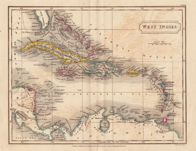
Central America & West Indies
North America
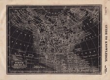
( Page 1 of 8 )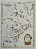
East America Rigobert Bonne 1798
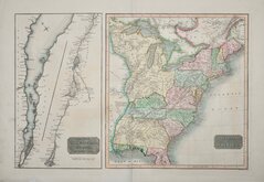
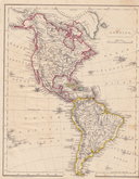
United States and St Lawrence River 1817
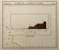
Saint Elias and Monserrate 1827
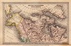
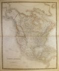
Canada 1831
North America by Pinnock 1834
Johnston 1843
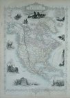
North America 1850
America by Becker 1850


£275 United States and St Lawrence River
Ref: 6456xb
Add to
basket
Thanks,Your Product Has Been Added To Basket

62x42 cm
UNITED STATES OF AMERICA.
THE COURSE of the RIVER S.T LAURENCE, from LAKE ONTARIO to MANCOUGAN POINT.
J.& G.Menzies sculp.t Edin.r
Two maps engraved on separate plates printed on one sheet.
The right map shows the eastern United States from the Mississippi to the Atlantic with a great amount of detail relating to treaties and territorial changes at the time.
The left map shows the St Lawrence river from its mouth to Lake Ontario, an important trading route.
Engraved by J. & G. Menzies of Edinburgh established by John Menzies (fl.1792-1851) and George Menzies (fl.1811-1831). for publication in Thomson's New General Atlas...Edinburgh, London & Dublin 1817.
John Thomson (fl.1804-1837), an Edinburgh publisher, employed several engravers on his atlas.
Light diagonal crease adjacent to St Lawrence river but it remains a fine and historically significant map in very good condition and in full original hand colour.
Quick Links

South America
World Maps and Charts
×