
English Counties
Folding Maps
( Page 5 of 17 )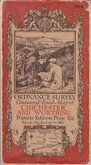
O.S. Chichester Worthing 1920
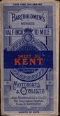
Bartholomew Kent 1922
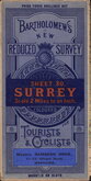
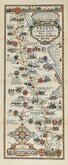
Bartholomew Surrey 1924
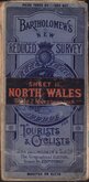
Bartholomew North Wales 1924
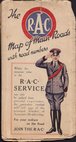
R.A.C. England 1925
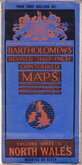
Bartholomew North Wales 1929
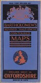
Bartholomew Oxfordshire 1929
Alfred Taylor 1930


86x59 cm
SURREY
BARTHOLOMEW'S REVISED HALF-INCH MAP
GREAT BRITAIN. SHEET 9
THE GEOGRAPHICAL INSTITUTE, EDINBURGH
COPYRIGHT-JOHN BARTHOLOMEW & SON. LTD.
Cloth backed.
Condition: Fair. Owner's name and address on back. Some fold splits. Remains of seller's label to cover.
Quick Links


Ordnance Survey Maps

Regional Maps of England & Wales
×