
Ordnance Survey Maps
Folding Maps
( Page 8 of 17 )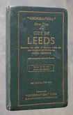
Leeds Geographia 1937
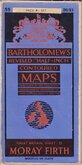
Bartholomew Moray Firth 1940
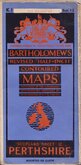
Bartholomew Perthshire 1941
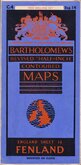
Bartholomew Fenland 1942
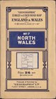
Geographia North Wales 1943
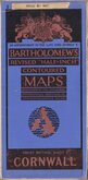
Bartholomew Cornwall 1944

Bartholomew South Yorks and Humber 1944
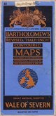
Bartholomew Vale of Severn 1947


86x59 cm
MID-WALES
BARTHOLOMEW'S REVISED HALF-INCH MAP
GREAT BRITAIN. SHEET 22
THE GEOGRAPHICAL INSTITUTE, EDINBURGH
COPYRIGHT-JOHN BARTHOLOMEW & SON. LTD.
Cloth backed.
Condition: Very Good. Light rubber stamp to front cover (Sun Insurance)
Quick Links


Regional Maps of England & Wales

English Counties
×