
Ordnance Survey Maps
Folding Maps
( Page 5 of 17 )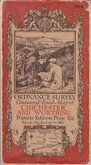
O.S. Chichester Worthing 1920
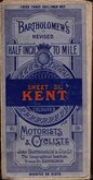
Bartholomew Kent 1922
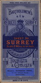
Bartholomew Surrey 1924
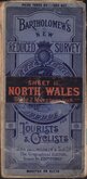
Bartholomew North Wales 1924
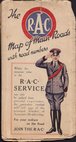
R.A.C. England 1925
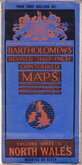
Bartholomew North Wales 1929
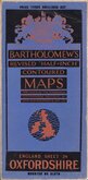
Bartholomew Oxfordshire 1929
Alfred Taylor 1930


85x49 cm
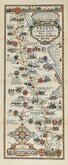
Wharfedale. No.32 in a series of 62. BARTHOLOMEW'S REVISED "HALF INCH" CONTOURED MAPS.
Paper printed, pasted on linen in paper covers.
Small owner's signature top corner and date verso but otherwise fine & bright.
Quick Links


Regional Maps of England & Wales

English Counties
×