
Historical Maps
Far East & India
( Page 4 of 5 )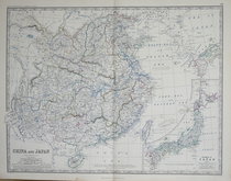
China & Japan - Johnston 1869
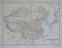
Chinese Empire & Japan - Barholomew 1880
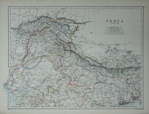
Northern India - Johnston 1884
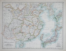
China & Japan - Johnston 1884
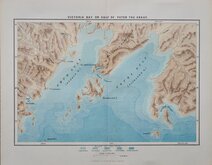
Peter The Great Gulf 1885
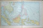
East Indies - Cram 1890
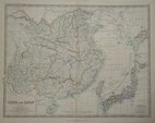
China & Japan - Johnston 1893
China & Japan - Bartholomew 1898

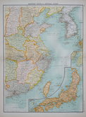
£35 China & Japan - Johnston
Ref: a6036.34
Add to
basket
Thanks,Your Product Has Been Added To Basket

58x45 cm
CHINA & JAPAN | BY KEITH JOHNSTON. F.R.S.E.
Large, highly detailed lithographic printed map published in The Royal Atlas Of Modern Geography Exhibiting, in a series of entirely original and authentic maps, the present condition of geographical discovery and research in the several countries, empires, and states of the World by Alexander Keith Johnston geographer to the Queen for Scotland...William Blackwood & Sons Edinburgh and London MDCCCLXIX.
Overprinted in blue indicating rivers and sea and hand coloured in line and wash indicating political boundaries.
Inset map of the ISLANDS OF JAPAN
Good clean example.
Quick Links


Eastern Europe & Turkey

Asia
×