
Northumberland Maps
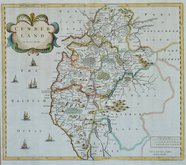
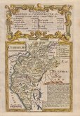
Cumberland Maps
( Page 1 of 6 )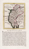
John Seller 1694 [1784]
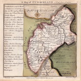
Robert Morden 1695 [1722]
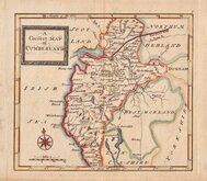
John Cary 1709 [1805]
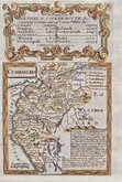
Emanuel Bowen 1720
Emanuel Bowen 1720
Thomas Badeslade 1742
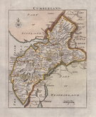
Thomas Read 1744 [1753]
Thomas Hutchinson 1748


32x39 cm
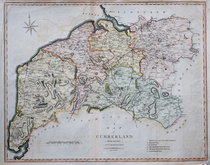
HOBSON FOX HUNTING MAP
CUMBERLAND
BY J. & C.WALKER
Published by Longman, Rees, Orme, Brown & Co. Paternoster Row London.
Lithographic transfer from John & Charles Walker's map first published from 1837. Between 1839 and 1880, the plates were used for a series lithographic transfers overprinted with hunt information in fox-hunting atlases published by William Colling Hobson. Each issue showed the hunt boundaries and Places of the meeting of Foxhounds. The hunt boundaries and organisers changed regularly and there were several editions with varying hunt information.
This map of Cumberland includes Mr Salkelds hunt issued c.1850
Quick Links


Westmorland Maps

Scotland Maps
×