
Scotland Maps
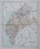
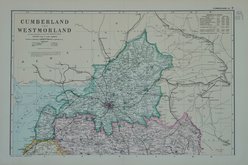
Cumberland Maps
( Page 6 of 6 )

17x25 cm
WOOD ENGRAVING
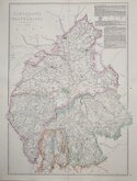
No. XLVII | SUPPLEMENT TO PINNOCK'S GUIDE TO KNOWLEDGE |PRICE ONE PENNY
CUMBERLAND
London, W.Edwards, Ave Maria Lane.
J.Archer sc. 100 Drummond St Euston Sq.
Woodblock engraved map by Joshua Archer printed with a white line on a black ground and published by W. Edwards in The Guide to Knowledge edited by W Pinnock in 1833. The maps in this format were issued in this single publication, The printing method was not popular and was not repeated for county maps. but were later printed by lithographic transfer by Thomas Johnson in his rare publication Johnson's Atlas of England in 1847 & 1863.
Very good clean example.
Quick Links


Northumberland Maps

Westmorland Maps
×