
Northumberland Maps
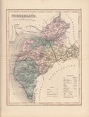
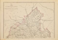
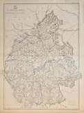
Cumberland Maps
( Page 5 of 6 )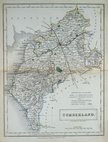
Sidney Hall 1833 [1852]
Roger Creighton 1835
Josiah Neele 1835
Thomas Moule 1837 [1845]
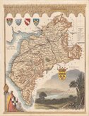
J. & C.Walker 1837 [1850]
Joshua Archer 1842 [1858]
Edward Weller 1862
Edward Weller 1862 [1863]


10x15 cm
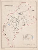
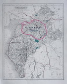
SIMPLE MAP SHOWING THE MAIN RIVERS.
CUMBERLAND.
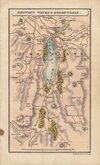
Engraver unknown, this series of maps were first published in England delineated; or a geographical description of every county in England and Wales...(by John Aikin) London, J. Johnson 1788. There were five further issues of the work until 1809.
Some marks, including over title but still a good example in wash hand colour.
Quick Links


Scotland Maps

Westmorland Maps
×