
Sea Charts
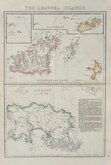
Channel, Scilly and other small islands.
( Page 2 of 2 )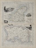
Channel Islands. John Rapkin 1851
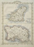
Channel Islands John Rapkin 1851
Channel Islands. John Rapkin 1851 [c.1860]
Cassell Petter & Galpin 1863 [1867]
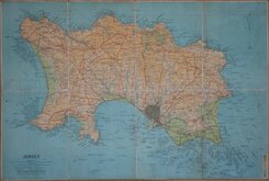
Jersey. Anonymous. 1930
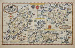
Alfred Taylor 1932 [1936]
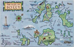
Scilly Isles Map Post Card 1970

£35 Channel Islands. John Rapkin
Ref: 5037
Add to
basket
Thanks,Your Product Has Been Added To Basket

24x35 cm
ALSO KNOWN AS TALLIS MAPS.
CHANNEL ISLANDS
The illustrations by H.Winkles & Engraved by E.Radclyffe.
The Map Drawn & Engraved by J. Rapkin.
JOHN TALLIS & COMPANY, LONDON & NEW YORK.
Published in The Illustrated Atlas and Modern History of the World...Edited by R. Montgomery Martin Esq. by John Tallis and Company, London and New York 1851. The work was re-issued a number of times until about 1865 and the maps were then used by Montgomery Martin, the author of the text in the Illustrated Atlas, in his British Colonies from 1854. The final appearance of the maps, with vignettes erased from the plate, was in geographical dictionaries and encyclopaedias until about 1880.
John Rapkin (1813-1899) was born in Southwark, the son George Rapkin, shoemaker, and his wife Elizabeth Harfy. His brother Richard also became an engraver while another brother, William Harfy Rapkin, became a copperplate printer. John married Frances Wilmot Rudall on 4th January 1837 at St George, Hanover Square. The 1851 census records them living in Clerkenwell with a family of eight children and a servant. He traded as John Rapkin & Son 1867-1883 and John Rapkin & Sons by 1887. He died aged eighty five in 1899, shortly after the death of his wife of over sixty years. His sons John Benjamin Rapkin (1837-1914), Alfred Thomas Rapkin (1841-1905), Joseph Clarke Rapkin (1846?-1912) and Frederick William Rapkin (1859-1945) all became engravers and the Rapkin firm continued until the 1970’s.
Centrefold Original outline hand colour.
SPECIAL OFFER MOUNT OPTION AVAILABLE ON THIS ITEM AT CHECKOUT FOR UK CUSTOMERS.
Quick Links


British Isles

Europe
×