
South America
Central America & West Indies
( Page 1 of 3 )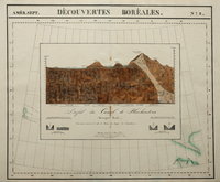
Huehuetoca, Mexico. 1827
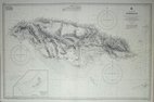
Jamaica 1970
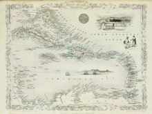
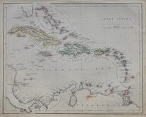
West Indies by Tallis 1851
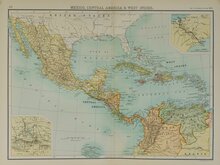
Mexico Central America West Indies 1898
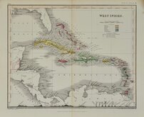
West Indies by Petermann 1860
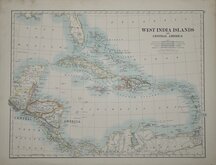
West India Islands 1884
West Indies by Becker. 1850
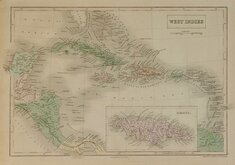
West Indies by Hall 1843


24x32 cm
MEXICO
John Bartholomew & Co.
Mexico and Central America with Galapagos Islands and inset map of British Honduras.
Map verso: CALIFORNIA, NEVADA, OREGON, | WASHINGTON, IDAHO, UTAH, ARIZONA | AND PART OF MONTANA.
(Please note this is also listed under North America but they printed on the same sheet, price is for both maps.)
Colour printed lithograph by John Bartholomew & Co. published in The English Imperial Atlas and Gazetteer of the World By J. G. Bartholomew, F.R.S.E., F.R.G.S. London T. Nelson & Sons, Paternoster Row Edinburgh and New York (1892)
Quick Links


Sea Charts
North America
×