
South America
Central America & West Indies
( Page 1 of 3 )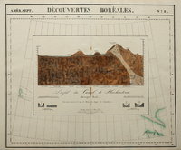
Huehuetoca, Mexico. 1827
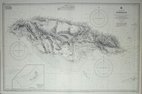
Jamaica 1970
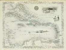
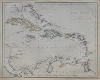
West Indies by Tallis 1851
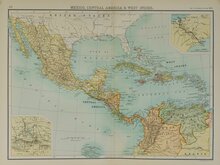
Mexico Central America West Indies 1898
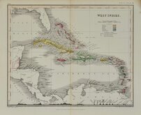
West Indies by Petermann 1860
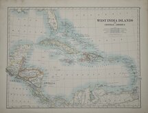
West India Islands 1884
West Indies by Becker. 1850
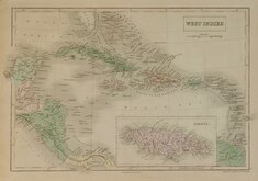
West Indies by Hall 1843


100 x 65 cm
WEST INDIES | JAMAICA | Surveyed by Staff Comr. G. Stanley, R.N. 1873-5; and Lieutt. T.F. Pullen, R.N., 1876-9. | Additional soundings from surveys by H.M.S. Vidal 1954-57 | and from a United States Government Chart of 1957. | With corrections to 1959. | ....
London. Published at the Admiralty. 27th October 1880 under the Superintendence of Captain F. J. Evans, R.N. C.B. F.R.S Hydrographer. New editions 23rd Jany. 1914, 14th August 1914, 5th March 1915. | Large Corrections 7th Aug. 1959.
Inset of Morant Cays.
Large Admiralty Sea Chart engraved 1880 with corrections to 1970.
Printed 1970 with manuscript additions in purple ink to 1973.
Quick Links


Sea Charts
North America
×