
South America
Central America & West Indies
( Page 1 of 3 )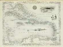
West Indies by Tallis 1851
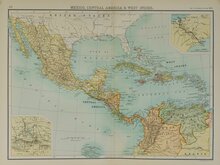
Mexico Central America West Indies 1898
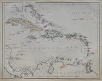
West Indies by Petermann 1860
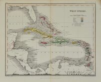
West India Islands 1884
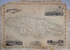
Jamaica 1851
West Indies by Becker. 1850
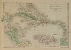
West Indies by Hall 1843
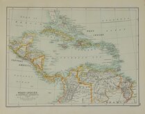
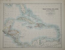
West Indies Central America 1892


35x25 cm
JAMAICA
Steel engraved map by John Rapkin first published in parts from the end of the 1840's and issued as a complete volume, The Illustrated Atlas in 1851. The work was re-issued a number of times until about 1865 and the maps were then used by Montgomery Martin, the author of the text in the Illustrated Atlas, in his British Colonies from 1854. The final appearance of the maps, with vignettes erased from the plate, were in geographical dictionaries and encyclopaedias until about 1880.
This map of the World on Mercators projection was published in The Illustrated Atlas of 1851.
Vignettes of Port Royal Harbour, Kingston, Port Antonio, Sugar Mill.
In original colour without centrefold but a very poor copy: Severe fraying and chipping at edges affecting decorative border, 10cm tear into map at bottom right edge, severe browning and staining, creasing at top edge.
Quick Links

Sea Charts
North America
×