
Africa
Australasia & Pacific
( Page 3 of 6 )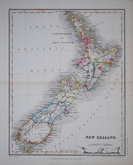
New Zealand by Petermann 1860
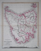
Tasmania by Petermann 1860

Australia by Petermann 1860
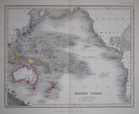
Pacific Ocean by Petermann 1860
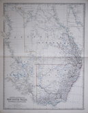
Queensland New South Wales 1861
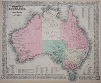
Australia by Johnson 1864
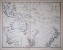
Oceania by Johnston 1869
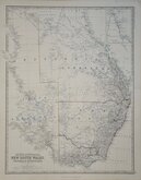
New South Wales Johnston 1869

£35 New Zealand by Petermann
Ref: 6003.37
Add to
basket
Thanks,Your Product Has Been Added To Basket

21x26 cm
NEW ZEALAND
Petter & Galpin. London E.C. | Drawn and engraved by J Dower. Pentonville, London.
LONDON, PUBLISHED BY WARD & LOCK. 158, FLEET STREET. E.C.
First published in The Library Atlas of Physical and Political Geography...by Augustus Petermann, F.R.G.S.... WM. S. Orr and Co., London, 1854. This issue was published in A School Atlas of Modern Geography by Ward & Lock 1860.
Engraved on steel by John James Dower (1825-1901) son and successor of John Crane Dower (1791?-1847). He was described as an engraver aged 15 on the 1841 census. He was elected to the Royal Geographical Society on 9th January 1854, August Petermann, author of this work, was one of his proposers. He was recorded as a geographer on the 1871 census, living with his wife, Mary Ann Augusta, and three children, as wood engraver on the 1881 census, living with his wife, two daughters and two grandchildren. By 1891 he was lodging in Wanstead, now a widower, recorded as a map engraver and draughtsman. He died in Hackney in the first quarter of 1901.
August Heinrich Petermann (1822-1878) was born at Bleicherode am Eichsfelde, Prussia. He studied at Berghaus’s Geographische Kunstchule in Potsdam from 1839. He worked for Alexander Keith Johnston, the well known mapmaker from Edinburgh, from 1845 and sponsored by Johnston, was elected Fellow of the Royal Geographical Society 22 June 1846. He moved to London in 1847 and was appointed Physical Geographer and Engraver on Stone to the Queen 18 Jun. 1852. He returned to Germany in 1854, founded the journal Petermanns Geographische Mittheilungen 1855. Returning to England, he married Clara Mildred Leslie 3 Sep.1856 in Richmond, Surrey, with whom he had three children. He was awarded the RGS Founders’ medal in 1868 for his innovative work and thematic mapping. His marriage was dissolved in 1877 and he married Tony Pfister 1878, but committed suicide 25 Sep.1878. Petermann’s influence in the world of cartography during his lifetime is demonstrated by the number of geographic physical features named after him: Petermann Ranges, Antarctica, Petermann Island, Antarctica, Petermann Ranges, Australia, Petermann Peak, Greenland, Petermann Fjord, Greenland, Petermann Glacier, Greenland, Petermann Peninsula, Greenland, and Cape Petermann, Svalbard.
Cross section through the North Island on bottom border.
Good example in original hand colour depicting the provinces.
Quick Links
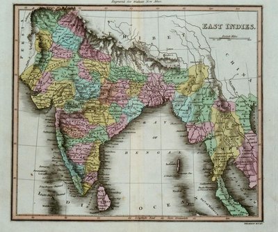
Far East & India

Sea Charts
×