
Far East & India
Australasia & Pacific
( Page 1 of 6 )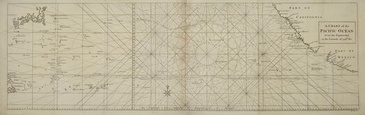
Pacific Ocean by Anson 1748
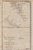
Vanuatu & New Caledonia Cook 1776
South Sea Islands by Starling 1831
Australasia by Pinnock 1834
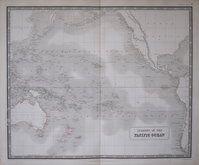
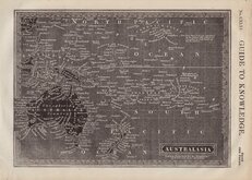
Pacific Islands by Johnston 1843
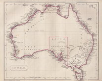
Australia by Becker 1850
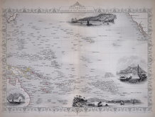
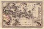
Polynesia by Tallis 1851
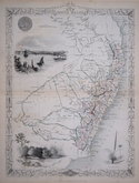
New South Wales by Tallis 1851


45x58 cm
NEW ZEALAND | According to the "New Zealand Counties Act 1876" | BY KEITH JOHNSTON. F.R.S.E. | Engraved and published by W. & A.K.Johnston, Edinburgh & London.
Large, highly detailed lithographic printed map published in The Royal Atlas Of Modern Geography Exhibiting, In A Series Of Entirely Original And Authentic Maps, The Present Condition Of Geographical Discovery And Research In The Several Countries, Empires, And States Of The World By The Late Alexander Keith Johnston ... With Additions And Corrections To The Present Date By T.B. Johnston ...W.& A.K. Johnston, Edinburgh And London, MDCCCXCIII.
Overprinted in blue indicating rivers and sea and hand coloured in line and wash indicating county boundaries. Dstance table below the title giving distance and times for Screw Steamer routes to and from Wellington.
Some discolouration at centrefold. A superbly detailed map in fine original hand colour.
Quick Links

Sea Charts
Africa
×