
General & Collectable
Antiquarian
( Page 1 of 7 )
The Compleat Surveyor by William Leybourn
Historical Antiquities of Hertfordshire by Sir Henry Chauncy
Oratio Ad Graecos by Tatian
History of Hertfordshire by Nathaniel Salmon
The Journey Chester to London by Thomas Pennant
History of Knaresborough by E Hargrove
Beauties of Hertfordshire by Brayley
Beauties of Middlesex by Brayley & Britton

Request Condition Report
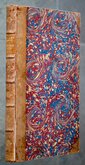
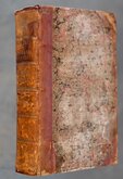
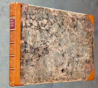
THE PEAK GUIDE, CONTAINING THE TOPOGRAPHICAL, STATISTICAL, AND GENERAL HISTORY OF BUXTON, CHATSWORTH, EDENSOR, CASTLETON, BAKEWELL, HADDON, MATLOCK, AND CROMFORD; WITH AN INTRODUCTION, GIVING A SUCCINT ACCOUNT OF THE TRADE AND MANUFACTURES OF THE COUNTY; AN ALPHABETICAL LIST OF NOBLEMEN AND GENTLEMEN'S SEATS, AND SEVERAL ROAD SKETCHES; Ornamented with a Map, Plans and East View of Chatsworth House, Haddon Hall, Willersley Castle, Bakewell and Matlock Churches, Ancient Monuments and Armorial Bearings.
BY STEPHEN GLOVER; EDITED BY THOMAS NOBLE, Esq.
DERBY: Printed for the Publisher BY HENRY MOZLEY AND SONS, AND SOLD AT THE VARIOUS SHOPS IN MATLOCK, BUXTON, AND CASTLETON AND EVERY BOOKSELLER IN THE COUNTY. 1845.
8vo. (14x23cm.) Brown cloth, embossed boards, glilt title to spine. xl,136 pp. Full page steel engravings of West view of Chatsworth House, Haddon Hall, Willersley Castle. Several wood block engravings in the text. 3 full page and 1 fold-out page plans of Chatsworth. Pull-out Genealogical tables of the Cavendish and Manners families. Steel engraved segmented and cloth mounted foldiing map of Derbyshire by Glover engraved by Josiah Neele loosely inserted.
Binding worn and loose with damage at head of spine. Ink manuscript date to spine. Spotting to steel engraved plates. Pencil signature inside front board.
For detais of the map see our listing under Derbyshire maps.
Quick Links
Map Books
Atlases & Road Books
×