
Worcestershire Maps
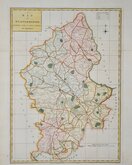
Staffordshire Maps
( Page 1 of 4 )
John Speed 1610 [1676]
Richard Blome 1673

Robert Morden 1695
Emanuel Bowen 1720
Thomas Read 1744 [c.1769]
Joseph Ellis 1765 [1773]

John Cary 1789 [1805]
John Haywood 1791


52x40 cm
BASSET & CHISWELL EDITION
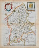
STAFFORD COUNTIE AND TOWNE with the ancient Citie LICHFIELD described
Performed by Iohn Speed and are to be sold by Th: Bassett in Fleet Street, and Ric Chiswell in St Pauls Curch yard.
John Speed (1552-1629), born in Cheshire, was a Tailor, becoming a member of the Worshipful Company of Merchant Taylors in 1580. He became interested in History and antiquities and became a member of the Society of Antiquaries and friend of William Camden. In 1611 he published his History of Great Britaine followed by his Theatre of the Empire of Great Britaine the following year. The Theatre was designed as the topographical section to his History and the inclusion of county maps with inset town plans has ensured Speed's name will be remembered. The maps were designed and engraved by Jodocus Hondius in Amsterdam from materials and instructions sent to him by Speed. Speed's main cartographical contribution was the town plans, Speed claiming authorship to those that include a scale of paces "by mine owne travails". The county maps are based on the surveys of Christopher Saxton and John Norden. The inclusion of the internal administrative divisions of the counties was a new innovation by Speed perpetuated in most county maps that followed for the next 300 years. The descriptive text on the back of the maps is taken from Camden and as the text had to be re-set for each issue enables us to date an individual map. On 29th April 1608 George Humble obtained the rights to print and sell the atlas for 21 years but publication did not actually start until 1611. Publication of John Speed's maps continued by various publishers until at least 1770, a publication period of 160 years.
This example is from the Bassett and Chiswell edition published in 1676.
Good condition in good later hand colour. No damage, repairs or restoration.
Quick Links

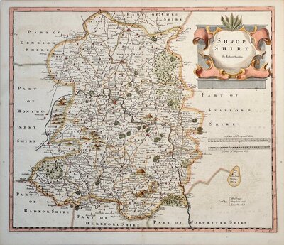
Shropshire Maps

Derbyshire Maps
×