
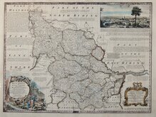
Whole of Yorkshire
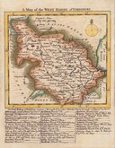
Yorkshire West Riding
( Page 1 of 3 )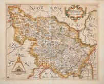
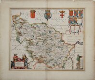
William Hole 1607 [1610]
Jan Jansson 1646
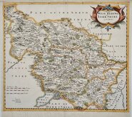
Robert Morden 1695
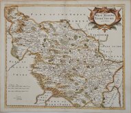
Robert Morden 1695 [1730]
Emanuel Bowen 1720
Kitchin & Jefferys 1749
Emanuel Bowen 1750 [1753]
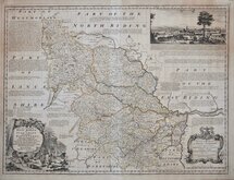
Emanuel Bowen 1750 [1763]


12x7 cm
COLOURFUL MINIATURE MAP.
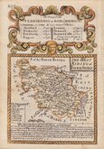
YORKSHIRE. W. RIDING.
Pub. by M.A.Leigh 421 Strand. | Sidy. Hall sculpt.
Miniature map engraved by Sidney hall and first published in Leigh's New Pocket Atlas of England and Wales in 1820. The little atlas was popular running to ten editions until the final issues in 1842 and 1843 by George Biggs.
Good hand coloured example from the 1834 edition with Leigh's new address at 421 Strand published after the reform bill.
SPECIAL OFFER MOUNT OPTION AVAILABLE ON THIS ITEM AT CHECKOUT FOR UK CUSTOMERS.
Ref. Whitaker Printed Maps of Yorkshire [352] (1834 edition not listed)
Quick Links


Yorkshire North Riding

Yorkshire East Riding
×