
Yorkshire East Riding
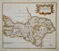
Yorkshire North Riding
( Page 1 of 3 )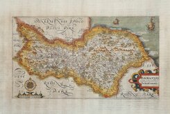
William Hole 1607
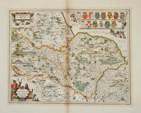
Jan Jansson 1646
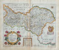
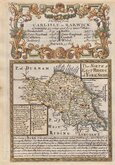
Richard Blome North Riding 1673
Richard Blome Richmondshire 1673
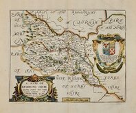
Richard Blome Richmondshire 1673
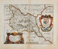
Robert Morden 1695 [1722]
Emanuel Bowen 1720
Emanuel Bowen 1763 [1777]

£15
Edward Weller George Philip & Son Ref: 6204we
Add to
basket
Thanks,Your Product Has Been Added To Basket

41x34 cm
LITHOGRAPHIC COLOUR PRINTED MAP.
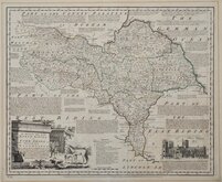
YORKSHIRE
(NORTH WEST SHEET)
GEORGE PHILIP & SON LONDON & LIVERPOOL
This series, engraved by Edward Weller, F.R.G.S. (1819-1884), one of the pioneers of lithograph printed maps, were first issued as loose sheet maps by George Phiiip & Son, printed by lithographic transfer and hand coloured from about 1864 and first published in atlas form, again by lithographic transfer but now overprinted in colours, in Philips' atlas of the counties of England... George Philip & Son, 1865. The series continued to be issued in various publications, undergoing many changes to the plates and alterations on the transfer until the beginning of the 21st century.
This map, overprinted in colours representing Parliamentary divisions & boroughs, was published in Philips’ atlas of the counties of England… in 1885.
Showing part of North Yorkshire from Knaresborough to Hawes, Barnard Castle and Stockyon, and part of Westmorland from Settle to Sedburgh.
Quick Links


Yorkshire West Riding

Whole of Yorkshire
×