
Yorkshire West Riding
Yorkshire North Riding
( Page 1 of 3 )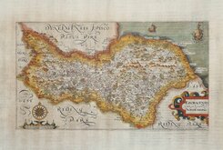
William Hole 1607
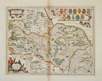
Jan Jansson 1646
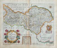
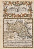
Richard Blome North Riding 1673
Richard Blome Richmondshire 1673
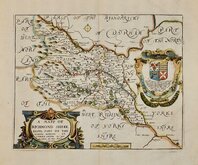
Richard Blome Richmondshire 1673
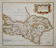
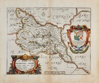
Robert Morden 1695 [1722]
Emanuel Bowen 1720
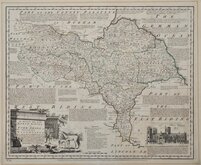
Emanuel Bowen 1763 [1777]

Request
Condition Report
FINE ENGRAVING WITH VIGNETTE OF YORK MINSTER.
MAP of the NORTH RIDING OF THE COUNTY of YORK, from an Actual Survey made in the Years 1817 & 1818. BY C. & J. GREENWOOD, Published by the Proprietors Greenwood & Co. 3, Burleigh St. Strand. LONDON. Corrected to the present period & Published April 1st. 1834.
ENGRAVED BY J&C WALKER.
The Greenwoods had planned to produce a set of new surveys of the English counties at an inch to a mile with the claim that they were to be based on new surveys. There is doubt about this claim, the maps appearing to be based on Ordnance survey and other sources but even so, finances were stretched and although an advertisement appeared about 1830 for a full set of English counties at 125 guineas, six counties were not actually completed and their business appears to have ceased trading. This set of reduced versions of their maps, published in The Atlas of the counties of England, from actual surveys made from the years 1817 to 1833, by C & J Greenwood. in 1834., were issued from the premises of John & Charles Walker, the firm initially employed, among others, by the Greenwoods as engravers.
Christopher Greenwood (1786-1855) and John Greenwood (1791-1867) were both born at Gisburn, Yorkshire, sons of John Greenwood, farmer or grazier, and his wife Ellin. The brothers worked in partnership from about 1821 until 1834 mainly producing and publishing large county maps.
Large vignette of York Minster with polling places lower left. References to the Wapontakes top left. Compass rose and Explanation key top right. Title lower right.
Toning to the paper from some of the pigments in the original hand colour. Pin holes to the corners. Several short tears to edges, a few into the printed margin repaired with archival tape verso. Toning around the border and verso from old mount board. Light additional creasing at centrefold. Two small stains to title. Despite these faults it is a large and attractive map with a large detailed vignette of York Minster.
Ref. Whitaker Printed Maps of Yorkshire [419]
Quick Links


Yorkshire East Riding

Whole of Yorkshire
×