
Gloucestershire Maps
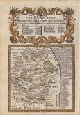
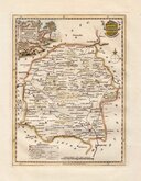
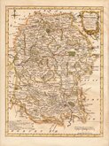
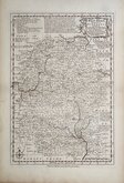
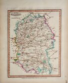
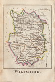
Wiltshire Maps
( Page 1 of 3 )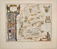
Jan Blaeu 1645
Owen & Bowen 1720
Thomas Kitchin 1751 [c.1786]
Thomas Kitchin 1763
Thomas Bowen 1767 [c.1770]
Benjamin Baker 1795 [c.1807]
Robert Butters 1803
John Cary 1808 [1809]


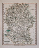
7x12 cm
COLOURFUL MINIATURE MAP
WILTSHIRE
Pub. by S.Leigh,18 Strand. | Sidy.Hall sculpt.
Miniature map engraved by Sidney Hall and first published in Leigh's New Pocket Atlas of England and Wales in 1820. The little atlas was popular running to ten editions until the final editions in 1842 & 3 published by George Biggs.
Fine hand coloured example from the first edition.
Quick Links


Hampshire Maps

Berkshire Maps
×