
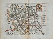
Yorkshire East Riding
Whole of Yorkshire
( Page 1 of 4 )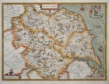
John Speed 1610 [1627]
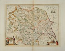
Jan Jansson 1646
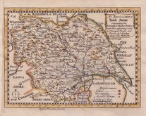
Richard Blome 1673
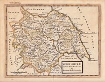
John Seller 1694
John Seller 1694 [c.1784]
Herman Moll 1724 [1753]
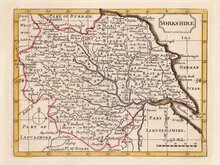
Badeslade, Thomas 1741
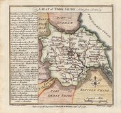
John Cowley 1743

£975
Bowen Kitchin Sayer Bowels Ref: 6475-8
Add to
basket
Thanks,Your Product Has Been Added To Basket
Request
Condition Report
SCARCE SET OF FOUR MAPS FROM THE ROYAL ENGLISH ATLAS.
Set of four maps by Emanuel Bowen and Thomas Kitchin from the Royal English Atlas...London 1777. All from the same issue and in original outline hand colour.
Ref. Whitaker Printed Maps of Yorkshire [248]
The maps are being offered individually under their category headings and FOR THE FULL DESCRIPTION AND IMAGES PLEASE GO TO THE INDIVIDUAL CATEGORY LISTINGS. (The whole of Yorkshire individual map is listed above in this category.)
Until an individual map is sold the set is being offered here at a discounted price.
Quick Links


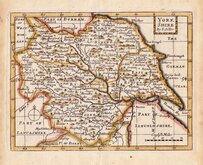
Yorkshire North Riding

Yorkshire West Riding
×