
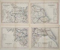
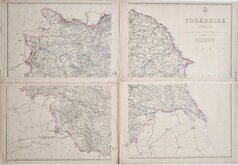
Yorkshire East Riding
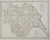
Whole of Yorkshire
( Page 3 of 4 )
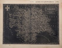
Henry Teesdale Yorkshire 1828
Roger Creighton 1831 [c.1840]
Selina Hall 1833
Joshua Archer 1842 [1848]

Hobson's Yorkshire 1843
Reuben Ramble 1845
Charles Newton Yorkshire 1847
Edward Weller 1862

£30
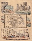
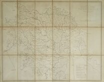
Reuben Ramble Darton & Clark Ref: 6489wg
Add to
basket
Thanks,Your Product Has Been Added To Basket

15x19 cm
SCARCE JUVENILE PPUBLICATION.
YORKSHIRE
Lithographic transfer published in Reuben Ramble's Travels through the Counties of England by Darton & Clark (and Darton & Co.) between 1845 an 1850. The small map was first issued, printed from the copperplate, in a set of playing cards by Thomas Crabb c.1819, followed by Miller's New Miniature Atlas... Robert Miller, 1821, and Darton's New Miniature Atlas...William Darton, 1822 & 1825.
William Darton (1781-1854), the publisher above, was the son of William Darton (1755 -1819), engraver, bookseller, printer, publisher, map & print-seller, and children's author, born in Tottenham, the son of John Darton, innkeeper of The Coach and Six Horses. He was a pioneer in publications for children. Both William Darton jnr's sons, Thomas and William, took up the same business separately in 1804 and in partnership from 1806 until 1810. William later went into partnership with his son John Maw Darton (1810-1881) and on his retirement in 1837, John continued in partnership with Rev. Samuel Clark (1810-1875), as "Darton & Clark". It was this partnership that carried on the Darton family tradition of publishing children's works and produced the children's school atlas. Samuel Clark, under the pseudonym "Reuben Ramble", adding the topographical and historical views around the maps that had been in the possession of the Darton's for over 20 years, to "lure the youthful multitude into that most interesting and important of all studies - the geographical knowledge of their native land".
The survival rate of the Georgian school atlas was low and the maps are now scarce.
Toned with marking and scuffing. Closed tears left and right reaching map. Laid on matching paper. Original hand colour.
Quick Links


Yorkshire North Riding

Yorkshire West Riding
×