
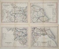
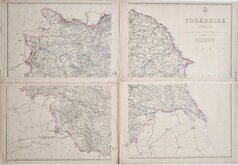
Yorkshire East Riding
Whole of Yorkshire
( Page 3 of 4 )
Henry Teesdale Yorkshire 1828
Roger Creighton 1831 [c.1840]
Selina Hall 1833
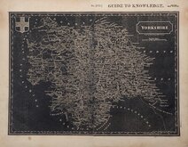
Joshua Archer 1842 [1848]

Hobson's Yorkshire 1843
Reuben Ramble 1845
Charles Newton Yorkshire 1847
Edward Weller 1862

£10
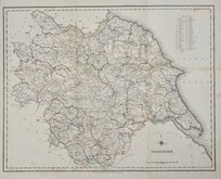
John Cary George & John Cary Ref: 6037.42
Add to
basket
Thanks,Your Product Has Been Added To Basket
Request
Condition Report
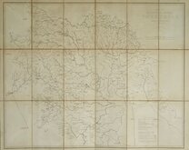
FROM CARY'S TRAVELLER'S COMPANION
The Turnpike Roads of YORKSHIRE By JOHN CARY, Engraver.
London. Published by G.& J.Cary, No. 86 St. James's Str.
This series of maps were first issued in Cary's Travellers Companion, London, 1790 by John Cary (1755-1835), the foremost mapmaker of his time. A very popular work, the plates were re-engraved for editions from 1806 and again for editions from 1822. This example of the map of Yorkshire is from this last version published from 1822 to 1835 and has the imprint of George & John Cary, both sons of John Cary who took over their father's business after the Strand premises burned down in 1820. George Cary (1787-1859) set up business with a new premises in St. James Street as senior partner with his younger brother John (1791-1852).
Unlike the other county maps in the series which were printed on a single page, the map of Yorkshire was engraved on a larger plate and folded several times into the pocket volume and as a consequence is often found with damage. This example has several tears with old repairs verso using linen and postage stamp sheet borders.
Original hand colour.
Ref. Whitaker Printed Maps of Yorkshire [359]
Quick Links


Yorkshire West Riding

Yorkshire North Riding
×