
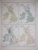
Scotland Maps
Whole of Britain & British Isles
( Page 1 of 2 )
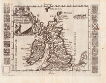
Roman Britain Robert Morden 1695
Daniel de la Feuille 1720
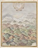
Hills of Britain 1842
John Rapkin 1851
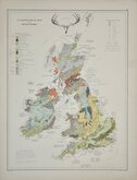
Palaeontological Johnston 1884
Ethnographic Johnston 1884
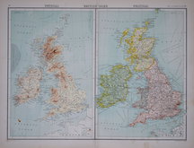
Products Population Rainfall Rivers 1892
John Bartholomew 1898

£5
The Times Illustrated London News Ref: 5833g
Add to
basket
Thanks,Your Product Has Been Added To Basket
Request
Condition Report
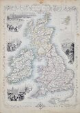
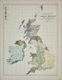
ELECTORAL MAP AT THE OCTOBER 1951 DISSOLUTION
THE ELECTORAL MAP OF GREAT BRITAIN, SHOWING THE STATE OF THE PARTIES AT THE OCTOBER DISSOLUTION.
COPYRIGHT MAP, REPRODUCED BY COURTESY OF "THE TIMES.'
The Illustrated London News October 20 1951.
Rust holes at centrefold staples.
Quick Links

Wales Maps

England & Wales
×