
England & Wales
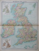
Whole of Britain & British Isles
( Page 2 of 2 )
G W Bacon British Isles 1910
Richardsons British Isles 1910
John Bartholomew 1922
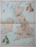
John Bartholomew 1922
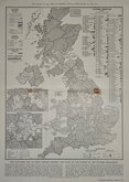
Electoral map 1951
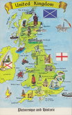
Britain Postcard 1970


23x31 cm
FOUR MAPS ON THE PAGE: PRODUCE, POPULATION, RAINFALL & TIDES, RIVERS.
LEADING PRODUCTS OF THE BRITISH ISLES
DENSITY OF POPULATION THROUGHOUT THE BRITISH ISLES
MEAN ANNUAL RAINFALL AND TIDAL FLOW OF THE BRITISH ISLES
THE RIVER BASINS AND WATER-PARTINGS OF THE BRITISH ISLES
The Edinburgh Geographical Institute | John Bartholomew & Co.
Colour printed lithograph published in The English Imperial Atlas and Gazetteer of the World by J.G. Bartholomew, F.R.S.E., F.R.G.S. London T. Nelson & Sons, Paternoster Row Edinburgh and New York. The map of Leading Products is overprinted in red rather than an addition to the transfer and indicates the main trades including the fisheries and fish distribution.
Quick Links

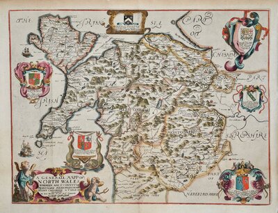
Wales Maps

Scotland Maps
×